Snow forecast to fall on TABLE MOUNTAIN on Sunday!
A cold front forecast to hit the Western Cape on Sunday, 7 July means it’s possible snow could fall on Table Mountain in Cape Town!
According to the latest Vox Weather update, another cold front is due to arrive on Thursday night with an even stronger front to move in on Sunday.
Thursday and Friday, 4 -5 July
More light snowfall is expected very late on Thursday over the high peaks of the Western Cape, the Matroosberg mountain range and over north-eastern Lesotho.
Light snow is also expected over northern high grounds (Sneeuberge and surroundings) in the Eastern Cape, southern Drakensberg and on the mountains around Uniondale.
Saturday, 6 July
Light snow is possible over the Cederberg mountains in the Western Cape and around Sutherland.
Sunday, 7 July
More significant and widespread snow possible over the Cape provinces as a stronger front reaches the country.
At the time of publishing, the weather model shows heavy disruptive snow could fall over the mountain peaks in the Western Cape (Matroosberg Nature Reserve, Cederberg and Swartberg Mountain Range), and Northern Cape (Nuweveld and Roggeveld mountains), including the town of Sutherland, spreading to the Great Karoo and the high-lying areas in the Cape provinces (around Calvinia, Loxton, Beaufort West, Molteno, Barkley East and surroundings), southern Drakenberg and Lesotho.
Snow chasers
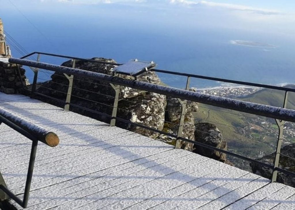
YES! Snow IS possible on Table Mountain.
Medium confidence
Freezing levels are likely to drop to about 1 000m to 1 200m on Sunday, which could mean a light snow dusting for Table Mountain, but this could quickly melt if it falls with rain or when it starts raining afterwards.
Medium to high confidence
Snow is still very likely to fall at the foot of the mountains at the Matroosberg Nature Reserve in the Western Cape on Sunday.
Monday, 8 July
Ground snow is possible on Sunday into Monday morning around the escarpment and over the high-lying areas and small towns in the Eastern Cape (around Barkly East, Molteno, Lady Grey and surrounding towns).
More snowfall is likely into Monday over the mountain peaks in the Western Cape (Matroosberg Nature Reserve, Cederberg and Swartberg Mountain Range, also including the Hottentots Holland mountains and Boland mountains), with ground snow possible in Ceres.
Snow showers are possible over the Northern Cape (Nuweveld and Roggeveld mountains), the town of Sutherland, spreading to the Great Karoo and the high-lying areas in the Eastern Cape with significant snow possible over the southern Drakensberg and Lesotho.
Very light snow is also possible on Monday as far north as Griekwastad, south of Postmasburg in the Northern Cape, and the southern parts of the Free State, but again, this could quickly melt if it falls with rain showers.
Small town bordering the Maluti mountains in the Free State (Ficksburg and Clarens) as well as the southern high-lying areas near Fauresmith and Reddersburg could see a light dusting of snow early on Monday morning.
Stay warm outside, fellow South Africans!
For the latest weather-related news, bookmark The South African website’s dedicated page
GOT PICTURES OF THE SNOW?
If so, let us know by clicking on the comment tab below this article or by emailing info@thesouthafrican.com or sending a WhatsApp to 060 011 021 1
You can also follow @TheSAnews on X and The South African on Facebook for the latest weather news.